DIGISKY AERIAL DRONE SERVICES

For marketing and measuring, our advanced aerial imagery solutions deliver stunning results and incredible details.

Digisky is a leading aerial imaging and photography company based in Tauranga, New Zealand, specializing in low altitude photography and video for a variety of commercial and technical applications.

Our drones, also known as UAVs, provide efficiency, cost-effectiveness, and increased safety for a wide range of operations.

Drones have proven to be a valuable tool in media coverage and filmmaking, as well as in marketing real estate, architecture, and construction. They are also useful for analyzing workflows and performing tasks such as land surveys, topographic surveying, photogrammetry, 3D mapping, and more.

With years of experience and expertise, Digisky (formerly Digipix) offers affordable, safe, and personalized aerial imaging services throughout the Bay of Plenty and nationwide.

Survey Data
Survey Data Services
A powerful and cost effective alternative to traditional ground surveying
Orchard/Farm Mapping
Mapping Services
Efficient farming starts with accurate mapping
Aerial Photography
Drone Services
An incredibly effective tool to feature your business, property or event
Inspections
Inspection Services
Monitoring elevated or difficult to access sites and structures made easy
NDVI Maps
Multispectral Analysis
Visualize your crops' health with NDVI maps
360° Interactive Panorama
360° Interactive Panorama Services
A powerful marketing tool for large projects

Technical Applications

UAVs or drones are versatile tools that offer a wide range of options and technical applications, with many yet to be discovered. At Digisky, we offer a variety of technical services utilizing UAVs, including:

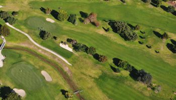
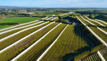
Orchard & Farm Mapping: Our Ground Sample Resolution (GSR) is close to 3cm/pixel, allowing us to provide high-resolution, ortho-rectified images of your property with accurate and precise measurement capabilities such as surface areas. We can create a map of your property highlighting relevant features such as hazards, loading bays, canopy areas, and more.

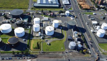
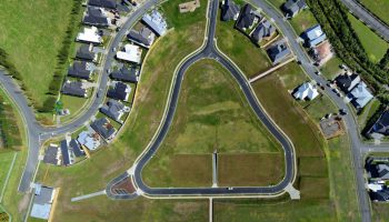
Aerial survey: When time and safety are critical, UAVs provide a powerful and cost-effective alternative to traditional ground surveying methods. We use digital photogrammetric systems for all our 3D and 2D digital mapping work, achieving impressive accuracy.

Construction progress: Our high-resolution cameras capture detailed imagery that is useful for project managers, architects, and presentations such as monthly reports. Historical records can be used for marketing or technical purposes, but most importantly, they provide invaluable photo evidence in the event of a claim.

Inspection: UAVs are ideal tools for monitoring elevated or hard-to-reach sites and structures. Aerial video and/or high-resolution photography provide accurate visual data without risking workers’ health and safety.

Multispectral (NDVI) Maps:In addition to our technical services utilizing UAVs, we also offer Multispectral Maps, particularly those utilizing the Normalized Difference Vegetation Index (NDVI). These maps are valuable tools in various fields, such as agriculture, environmental science, and remote sensing. NDVI calculates the relative health of vegetation by comparing the reflectance of near-infrared and red light, and can be used to identify areas of stress or disease in crops. Our high-resolution multispectral imagery can help farmers and researchers make informed decisions regarding their land and crops, leading to more efficient and sustainable practices.

Fixed Price

Clarity on price for the length of the contract

Safety

Part102 Certificated by the Civil Aviation Authority

Fast

Flying fast toward great customer experiences

Insured

Comprehensive cover is included in our service

Just a Few of Our Local Clients

We have successfully delivered high-quality aerial footage for these New Zealand businesses, as well as for many others.

Contact us anytime to find out more…

We are Awesome for creating Commercials

Eye-catching commercials will help your business grow faster and turn viewers into clients.

Our services for commercials are:

Aerial Photography: get a new perspective from above and capture the best of your subject of interest from any angle of view.

Aerial Panorama: need to capture a landscape or a large project in a single shot? Aerial panorama is the best tool to capture all of it, and we love doing those because panoramas look phenomenal.

Aerial 360° Interactive Panorama: the ultimate marketing tool. Immerse yourself within a full 360° panorama and interact with informative hot spots to provide viewers the essential information they need to know.

Aerial Video: take advantage of the latest technology with incredibly stable video footage. Whether you need specific video footage for your production or the conception and realisation of promotional video showcasing stunning aerial video footage, Digisky can help.