Your aerial imaging specialist
We deliver top-quality aerial imagery that exceeds customer expectations.
Are you looking for a powerful tool to help you optimize your agriculture practices and increase your yields? Look no further than Digisky and our cutting-edge NDVI and multispectral aerial imagery. With this technology, we can provide you with accurate and detailed information about your crops, allowing you to make more informed decisions and ultimately increase your profitability.
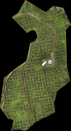
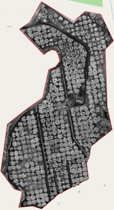
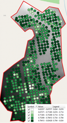
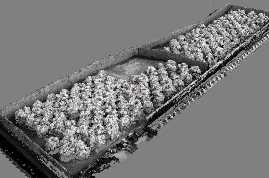
In orchards, where every tree counts, multispectral maps are an incredibly powerful tool for optimizing crop management. By analyzing the health and productivity of individual trees, we can identify areas that may require more attention or care. This allows for more targeted and efficient use of resources such as water, fertilizer, and pesticides. With Digisky’s multispectral maps, you can be confident that you’re making the most of your orchard and minimizing waste. By identifying areas with lower crop health or productivity, you can make targeted decisions to improve those areas, saving you money on unnecessary inputs like fertilizer or reducing labor costs by focusing only on areas that require attention. With Digisky’s technology, you can maximize your yield potential and reduce your costs in the long run.
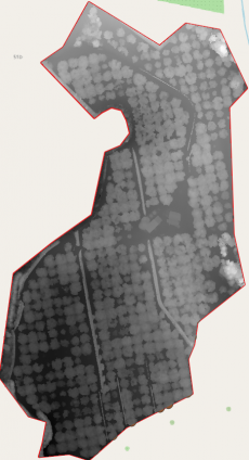
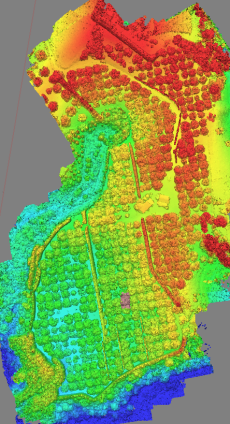
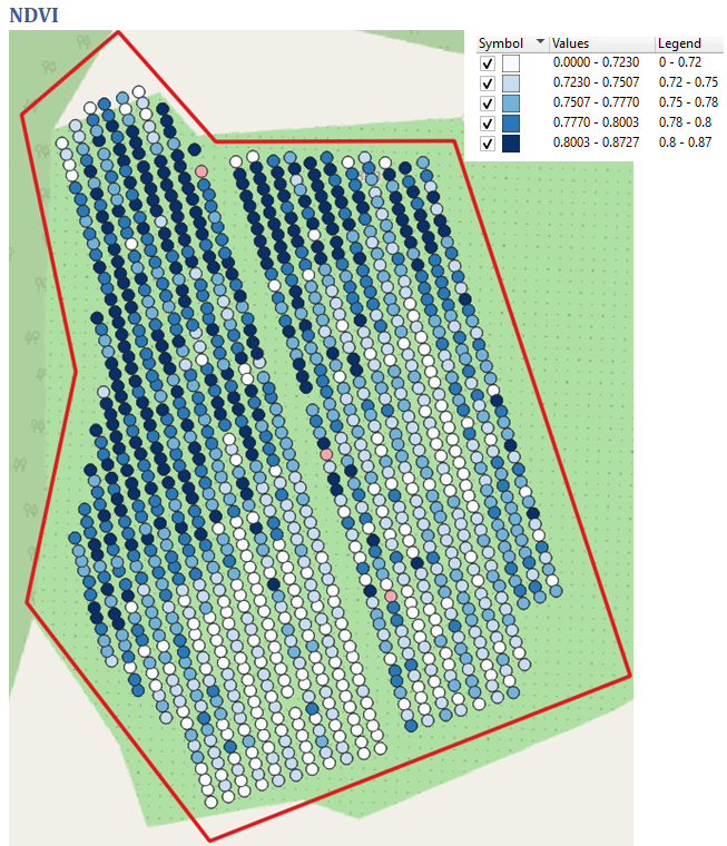
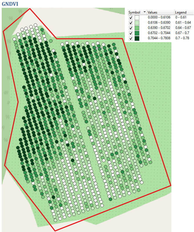
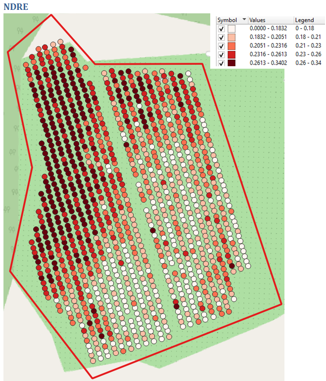
While NDVI is a valuable tool, Digisky’s multispectral maps can provide even more detailed information about your crops using other indices such as GNDVI and NDRE. GNDVI, or Green Normalized Difference Vegetation Index, is particularly useful for identifying vegetation cover and assessing overall plant health. It measures the difference in reflectance between the near-infrared and green spectral bands, allowing us to determine the amount of chlorophyll present in your crops. NDRE, or Normalized Difference Red Edge, is used to evaluate the level of photosynthetic activity in your crops. This index measures the difference in reflectance between the red and near-infrared spectral bands, which is particularly useful for analyzing crops with low chlorophyll content, such as stressed or mature plants. By using GNDVI and NDRE in addition to NDVI, we can more accurately identify areas of concern and track changes in your crops over time. This allows you to make more informed decisions about resource allocation and crop management, ultimately leading to increased yields and profitability. With Digisky’s multispectral maps and comprehensive analysis, you can be confident that you’re getting the most valuable and detailed data available.
At Digisky, we take precision seriously. That’s why our multispectral UAVs come equipped with RTK positioning technology. RTK, or Real-Time Kinematics, is a satellite navigation technique used to enhance the precision of position data from GNSS (Global Navigation Satellite System) receivers. With RTK, our UAVs are able to provide highly accurate and reliable data for our clients. This means you can trust that the information you’re receiving from Digisky is the most precise and valuable on the market.
Digisky is proud to have had the opportunity to present our results at the 10th World Avocado Congress, held in Auckland in April 2023. Our collaboration with Seeka, a longtime client for mapping, allowed us to showcase the power of our multispectral mapping technology for avocado orchards. Additionally, we recently worked with a research institute in Latvia to conduct a study on the different applications of NDVI, NDRE, and GNDVI over avocado orchards. The study not only focused on identifying areas that required more attention, but also included an accuracy assessment over tree measurements and their apparent volume assessment, in order to predict the yield or fruit crop. We are excited to continue providing cutting-edge solutions and innovations for our clients, and to help drive agriculture practices forward.
“Use of high-resolution drone imagery for crop estimation, health and size of GEM® and ‘Hass’ avocado trees in New Zealand”
We deliver top-quality aerial imagery that exceeds customer expectations.