Your aerial imaging specialist
We deliver top-quality aerial imagery that exceeds customer expectations.
“Photogrammetry is the process of using photographs to measure and map objects or surfaces. This technology has been used for decades in satellite and aerial mapping to create accurate maps and tools like Google Earth.
However, with the advancement of drone technology, high resolution cameras, and powerful photogrammetry software, it is now possible to achieve similar aerial surveys on a smaller scale at a lower cost.
By flying lower than planes or satellites, the resolution and accuracy of our photogrammetry surveys is significantly improved.”
Digisky provides the following services:
We offer transparent pricing for our technical services, with most jobs charged per area surveyed. The exception is for inspection jobs. Our unit of measurement is the hectare, and the larger the area to be surveyed, the lower the cost per hectare.
To get a free quote, simply provide us with the approximate location and surface area that needs to be surveyed. Contact us today to get started.
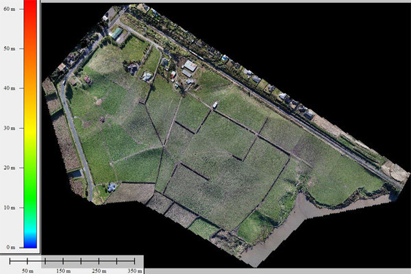
Ortho-rectified imagery: 2D export: Ortho-rectified image (Jpeg, TIFF)
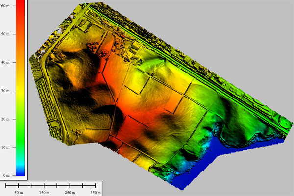
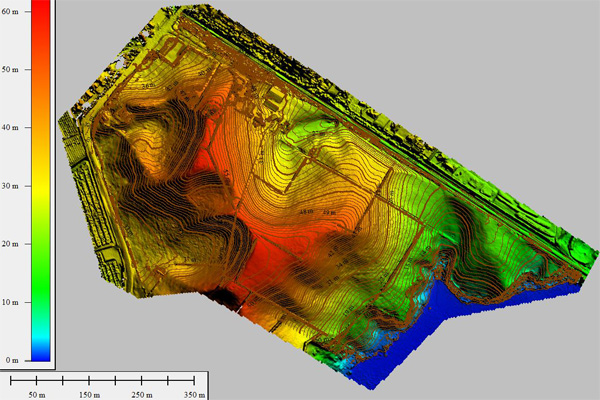
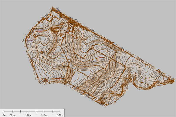
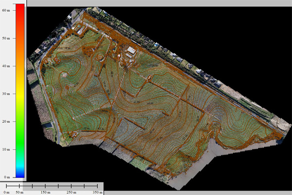
3D mapping: For most surveying companies, onsite data collection has always been a time-consuming part of their business operation.
We can collect millions of points in a fraction of the time and at a fraction of the cost of traditional methods. Our aerial mapping techniques provide valuable information that may not be obtainable through ground surveys. Plus, our operations can easily meet health and safety requirements as we do not need to enter hazardous areas and can access difficult sites. Save time and resources with our efficient 3D mapping services.
3D export: Surface (Geo TIFF), TIN surface (DXF), Contours Lines, Point grid, Profile etc…
Contact us for other outputs and file format availability
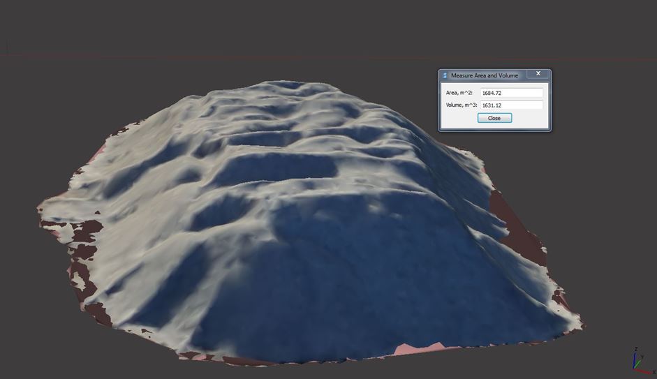
Need to measure volume on your maps quickly and accurately?
Digisky’s drone-based volume measurement service is the solution you’ve been looking for. It is a precise and cost-effective method that is faster and more accurate than traditional techniques. Plus, our drones can complete the task without disturbing your operations and with minimal safety risk.
With a tested accuracy of 97%*, you can trust the results you receive within 48 hours. Contact us today to learn more about how our volumetric measurement services can benefit your business.
*Based on a volumetric comparison conducted with Fulton Hogan on a 1600m3 stockpile using a Trimble SCS930 total station.
We deliver top-quality aerial imagery that exceeds customer expectations.